Item #40567 The Natural and Civil History of the French Dominions in North and South America. Giving a Particular Account of the Climate, Soil, Minerals, Animals, Vegetables, Manufactures, Trade, Commerce, and Languages. Together with The Religion, Government, Genius, Character, Manners and Customs of the Indians and other Inhabitants. Illustrated by Maps and Plans of the principal Places, collected from the best Authorties the Prince of Wales. Part I. Containing A Description of Canada and Louisiana. Part II. Containing Part of the Islands of St. Domingo and St. Martin, The Islands of St. Bartholomew, Guadaloupe, Martinico, La Grenade, and The Island and Colony of Cayenne. JEFFERYS, homas.
The Natural and Civil History of the French Dominions in North and South America. Giving a Particular Account of the Climate, Soil, Minerals, Animals, Vegetables, Manufactures, Trade, Commerce, and Languages. Together with The Religion, Government, Genius, Character, Manners and Customs of the Indians and other Inhabitants. Illustrated by Maps and Plans of the principal Places, collected from the best Authorties the Prince of Wales. Part I. Containing A Description of Canada and Louisiana. Part II. Containing Part of the Islands of St. Domingo and St. Martin, The Islands of St. Bartholomew, Guadaloupe, Martinico, La Grenade, and The Island and Colony of Cayenne.

The Natural and Civil History of the French Dominions in North and South America. Giving a Particular Account of the Climate, Soil, Minerals, Animals, Vegetables, Manufactures, Trade, Commerce, and Languages. Together with The Religion, Government, Genius, Character, Manners and Customs of the Indians and other Inhabitants. Illustrated by Maps and Plans of the principal Places, collected from the best Authorties the Prince of Wales. Part I. Containing A Description of Canada and Louisiana. Part II. Containing Part of the Islands of St. Domingo and St. Martin, The Islands of St. Bartholomew, Guadaloupe, Martinico, La Grenade, and The Island and Colony of Cayenne.

London. Printed for T. Jefferys at Charing-Cross. 1760. folio, 35.8cm, Two parts in one. First edition, first issue. 4ff, pp. 132, *129-*138, 133-168; 4 ff, pp. 246pp., with 18 folding engraved maps and plans; titles in red and black; in the second part pp. 54-55 are misnumbered 55-54, and pp. 86-87 misnumbered 90-91; in contemporary full calf boards expertly rebacked, gilt ruled raised bands, crush crimson morocco label, some occasional slight transfer from maps, complete with the 5 requisite additional leaves and with the correction slip pasted-over on p. 80 of the second part, a fine copy, rare. Item #40567

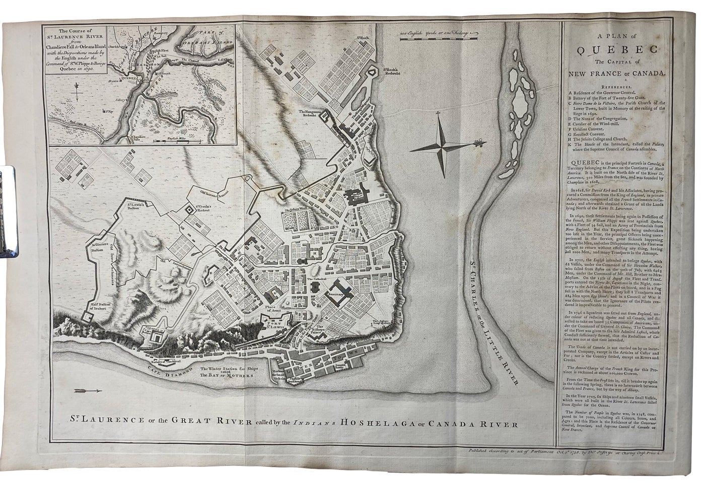
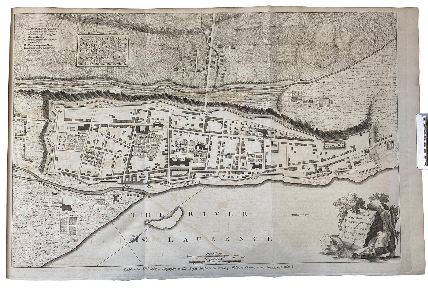
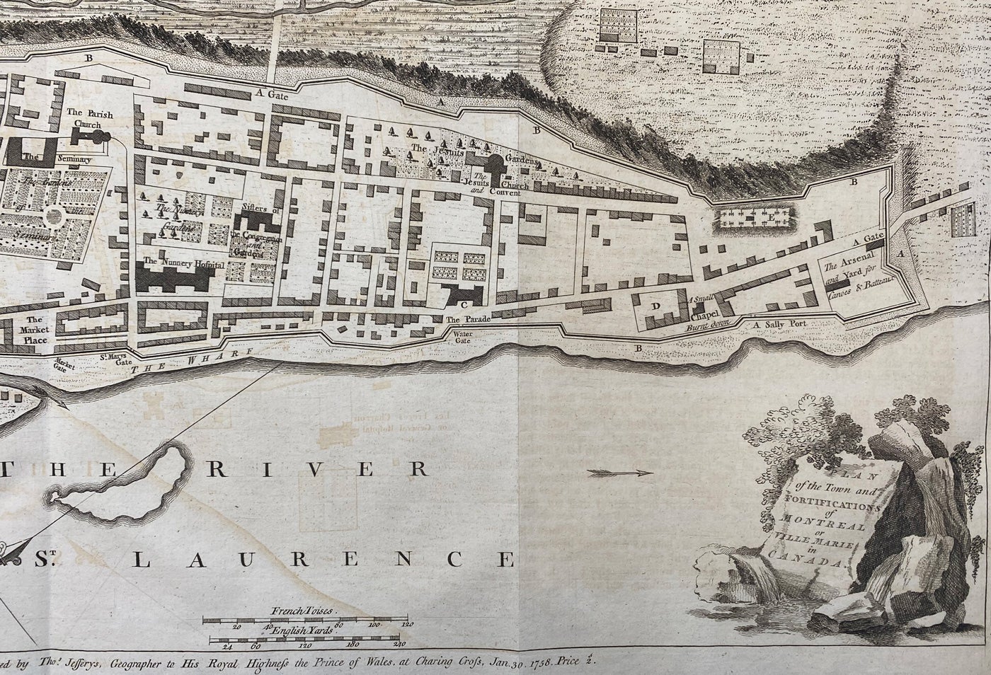
T.P.L. 319, Lande 471, Gagnon I-1778, Dionne II-635; Howes J-76, Streeter I:128, JCB 1260, Sabin 35964, Beinecke, Lesser Antilles, 228; Bell J35. The starred leaves *129-*138 were inserted to describe the siege and capture of Quebec in 1759; there was a second issue the same year, and another edition in 1761. The correction slip on p. 80 of the second part contains the revised list of 22 parishes of Guadeloupe. The first part of the work deals with Canada and Louisiana; the second part with the French holdings in the West Indies. An excellent work by one of the greatest of the English geographers. Many of the finely-engraved maps are of the greatest interest and importance. They comprise: Map of Canada and North part of Louisiana; large plans of Quebec and Montreal; New Map of Nova Scotia and Cape Britain, with the adjacent parts of New England and Canada; Plan of the city and harbour of Louisbourg; large plan of the Siege of Quebec with inserts of the Heights of Abraham and part of the Upper River of the St. Lawrence; Map of North America from d'Anville, improved with the back settlements of Virginia and the course of the Ohio; Plan of New Orleans, the capital of Louisiana, with insets; the Course of the Mississippi from Bayagoulas to the Sea, and the East Mouth of the Mississippi with plan of Fort La Balise; and many maps of the West Indies. An important work.

Price: $30,000.00 save 25% $22,500.00

See all items by ,