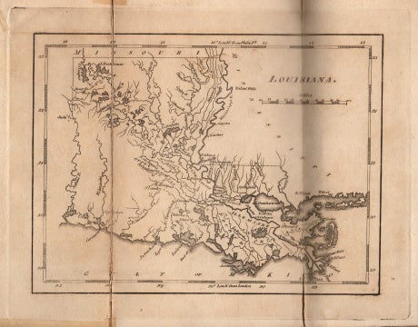
A Geographical Description of the State of Louisiana: Presenting A View of the Soil, Climate, Animal, Vegetable, and Mineral Productions; .... .. Being an Accompaniment to The Map of Louisiana.
Philadelphia. Printed for the Author, and Published by John Melish. 1816. 8vo, (in 4's), 19.5cm, The First Edition, xvii,(1)(Blank) [Appendix]; (18) [Attestations and Subscribers List]; (iii)-ix, (l) [Blank]; 270, (16)pp., [Vocabulary, Index, "Note to Page 128" and Errata]; rear folded engraved map, in contemporary full tree calf rebacked, raised bands, with the original red morocco label, wanting the front free fly, small repairs to the title-page and to heel of the first page of the Appendix, edges and verso of folds of the map have small remains of cellulose repairs, partial erasure at head of one page has caused paper thinning, ~ Few copies of the first edition are known to include a map; if a map is present it is usually Melish's large, folding map. Based on the stub to which it is attached, the map here was added soon after the work was published, and would appear to be Mathew Carey's map of Louisiana of 1817. (cgc). Item #40653
Note: Interestingly, the first half of the book is printed on a heavier whiter paper than the second half, with the exception of the Appendix, which is bound in at the beginning but the paper matches the lighter brown paper of the final part. Howes D-62. Sabin 18528. not in Streeter. Shaw & Shoemaker 37388. The author was deputy-surveyor for the United States from 1805-1810. "Conceiving the plan of a map and statistical account of Louisiana, he found government surveys inadequate and began a series of extensive explorations at his own expense. Interrupted by the British invasion, he acted as one of Jackson's topographical staff in the campaign of 1814-15. He returned to Pennsylvania in 1815... In Philadelphia, John Melish agreed to publish [this work]. Using Darby's statistical account and map, which [Andrew] Jackson and members of his staff considered accurate and valuable, the publisher compiled the Melish map of the United States, which was used as the basis for boundary delineation in the treaty of 1819 between the United States and Spain. This map, which brought profit and prestige to Melish, left the explorer 'to mourn for non-requited toil and misdirected credit'. " - (DAB V. p73.). Darby finally received partial compensation in 1854. This map shows many lakes and rivers, but very few towns.
Price: $2,400.00 save 25% $1,800.00