
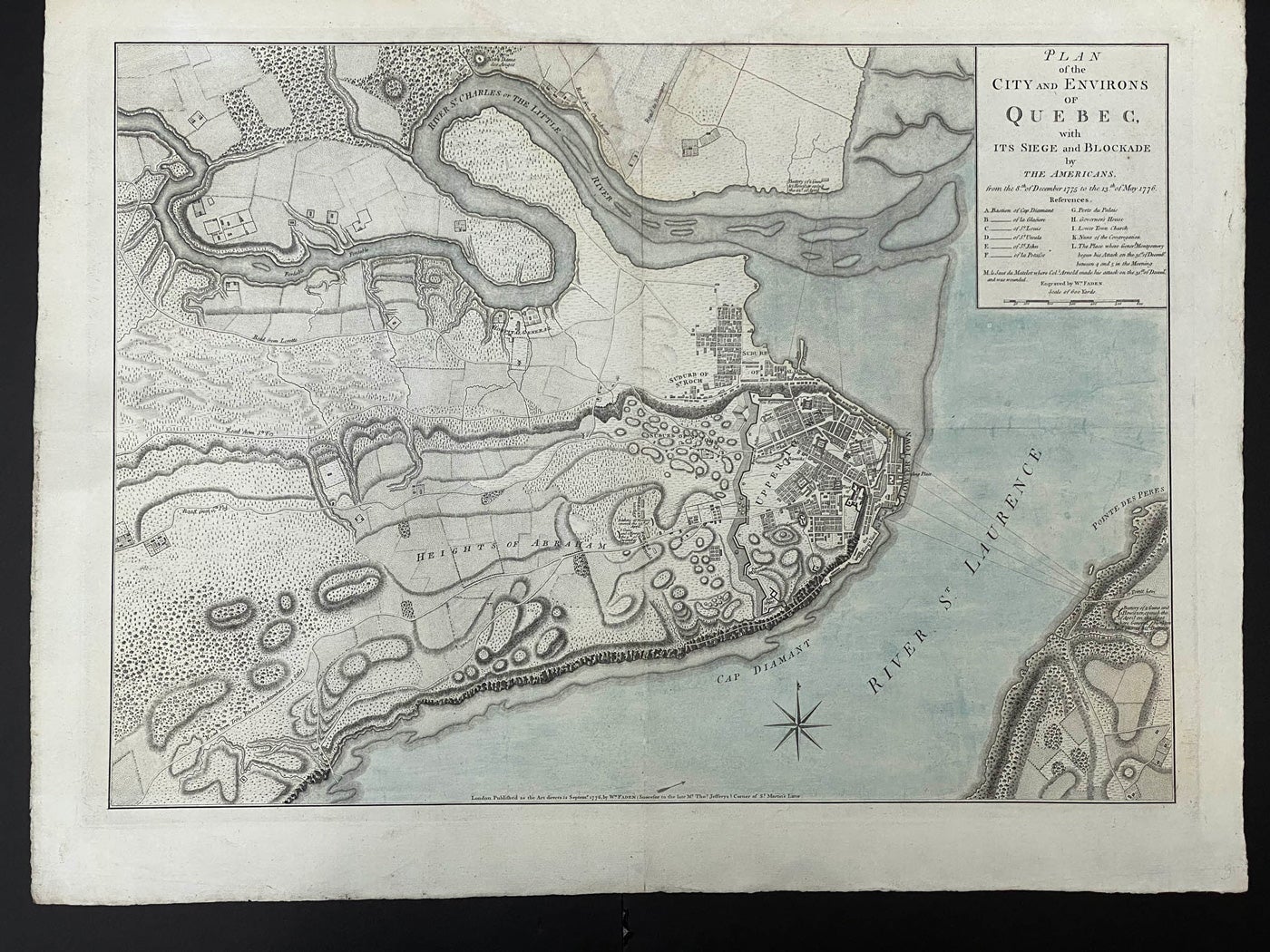
Plan of the City and Environs of Quebec, with It Siege and Blockade, by The Americans. from the 8th of December 1775 to the 13th of May 1776. M le Saut du Matelet where Col. Arnold made his attack on the 31st of December, and was wounded. Engraved by Wm. Faden.
London. Published, 12 Septemr, By Wm. Faden, (Succesor to the late Mr Thos. Jefferys). 1776. over all, 54x 705cm, (21.25"x 27.75"); image size: 44.5x 62cm (17.75"x 24.25"), original 1 colour, perfect expert invisible repair replacing a v-shaped chip mainly in the top margin and two inches deep with slight text loss, a fine clean copy thus, rare. Item #40718
Nebenzahl. Bibliography of Printed Battle Plans of the American Revolution, 1775-1796. - #44. Shows the American artillery positions, indicating number of guns, and the deployment of Arnold's troops on the Plains of Abraham. The fortifications of the city are delineated, and the references' include the positions where Montgomery and Arnold began their attack on 31 December 1775. Lines of fire from the battery across the Saint Lawrence at Point Levis are shown. - Kershaw IV-1041.
Price: $4,500.00 save 25% $3,375.00