"Boston and Surroundings".
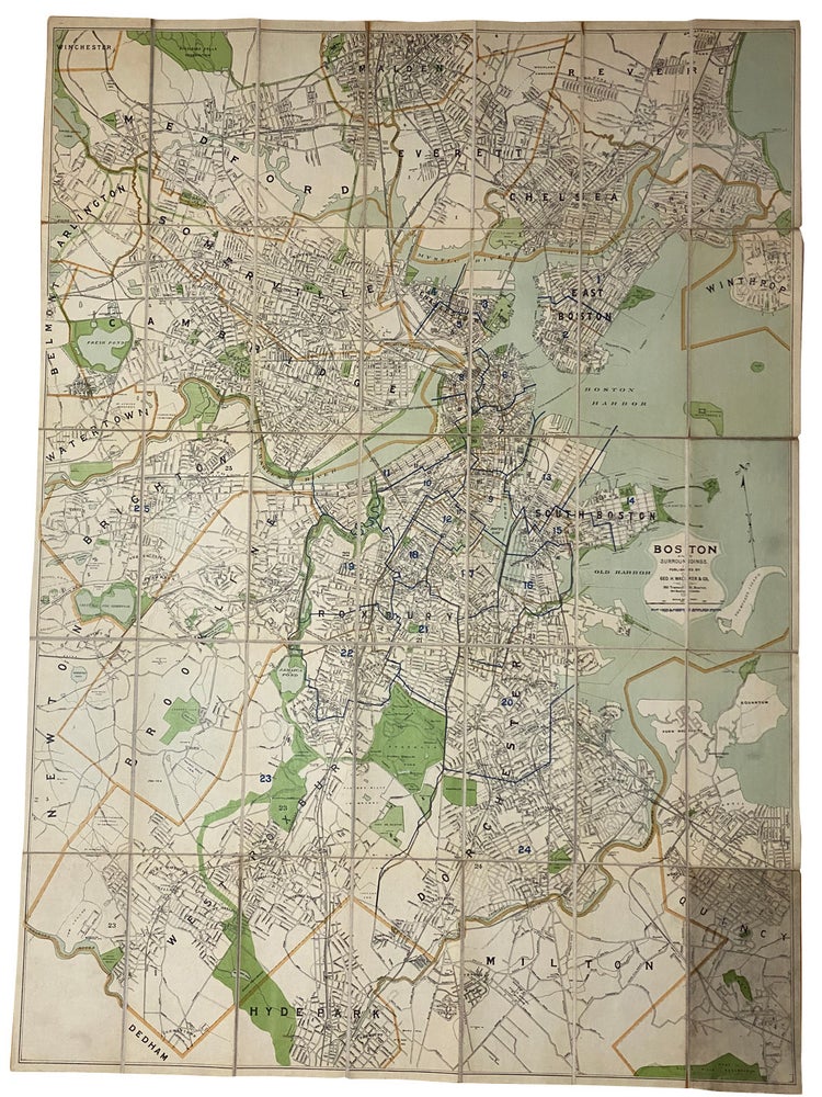
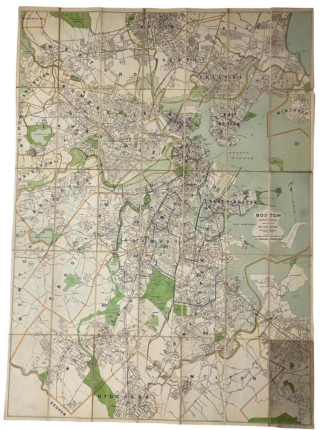
Boston. Published by Geo. H. Walker & Co. 1894. large linen backed folding map of Boston, dated 1894. Map size: 103x 75 cm (35"x 29.5") folded to 8vo, 21x 11cm, being a detailed street map with some colour borders, parks in green, Charles, Mystic Rivers & ports in blue, light wear on the folds, outside panels are dust worn, very good to fine (). Item #40915
Legend: "Blue lines 8, show new wards". A detailed map of Boston and area in the last decade of the 19th century. First settled in the 1630's by the Puritans by the 1890s had grown to a city of around 450,000.
Price: $300.00 save 25% $225.00
See all items by Massachusetts MAP BOSTON